


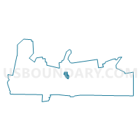
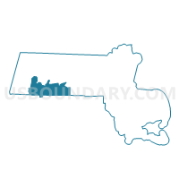
West Springfield Precinct 8, Hampden County, Massachusetts
About
Outline

Summary
| Unique Area Identifier | 594314 |
| Name | West Springfield Precinct 8 |
| County | Hampden County |
| State | Massachusetts |
| Area (square miles) | 3.05 |
| Land Area (square miles) | 2.82 |
| Water Area (square miles) | 0.23 |
| % of Land Area | 92.53 |
| % of Water Area | 7.47 |
| Latitude of the Internal Point | 42.14480800 |
| Longtitude of the Internal Point | -72.63454640 |
Maps

Graphs
Select a template below for downloading or customizing gragh for West Springfield Precinct 8, Hampden County, Massachusetts


Neighbors
Neighoring Voting District (by Name) Neighboring Voting District on the Map
- Chicopee Ward 2 Precinct B, Hampden County, MA
- Chicopee Ward 2 Precinct C, Hampden County, MA
- Chicopee Ward 3 Precinct A, Hampden County, MA
- Holyoke Ward 2 Precinct A, Hampden County, MA
- Holyoke Ward 5 Precinct A, Hampden County, MA
- Holyoke Ward 5 Precinct B, Hampden County, MA
- Springfield Ward 1 Precinct B, Hampden County, MA
- West Springfield Precinct 3, Hampden County, MA
- West Springfield Precinct 7, Hampden County, MA
Top 10 Neighboring County Subdivision (by Population) Neighboring County Subdivision on the Map
- Springfield city, Hampden County, MA (153,060)
- Chicopee city, Hampden County, MA (55,298)
- Holyoke city, Hampden County, MA (39,880)
- West Springfield Town city, Hampden County, MA (28,391)
Top 10 Neighboring Place (by Population) Neighboring Place on the Map
- Springfield city, MA (153,060)
- Chicopee city, MA (55,298)
- Holyoke city, MA (39,880)
- West Springfield Town city, MA (28,391)
Top 10 Neighboring Unified School District (by Population) Neighboring Unified School District on the Map
- Springfield School District, MA (153,060)
- Chicopee School District, MA (55,298)
- Holyoke School District, MA (39,880)
- West Springfield School District, MA (28,391)
Top 10 Neighboring State Legislative District Lower Chamber (by Population) Neighboring State Legislative District Lower Chamber on the Map
- Sixth Hampden District, MA (42,022)
- Fifth Hampden District, MA (39,880)
- Eighth Hampden District, MA (38,401)
- Tenth Hampden District, MA (37,829)
Top 10 Neighboring State Legislative District Upper Chamber (by Population) Neighboring State Legislative District Upper Chamber on the Map
Top 10 Neighboring 111th Congressional District (by Population) Neighboring 111th Congressional District on the Map
Top 10 Neighboring Census Tract (by Population) Neighboring Census Tract on the Map
- Census Tract 8124.01, Hampden County, MA (6,210)
- Census Tract 8111.02, Hampden County, MA (6,100)
- Census Tract 8121.01, Hampden County, MA (5,106)
- Census Tract 8122.01, Hampden County, MA (4,600)
- Census Tract 8109.02, Hampden County, MA (4,578)
- Census Tract 8122.02, Hampden County, MA (4,043)
- Census Tract 8007, Hampden County, MA (4,000)
- Census Tract 8124.04, Hampden County, MA (3,881)
- Census Tract 8121.03, Hampden County, MA (3,836)
- Census Tract 8109.01, Hampden County, MA (1,948)